








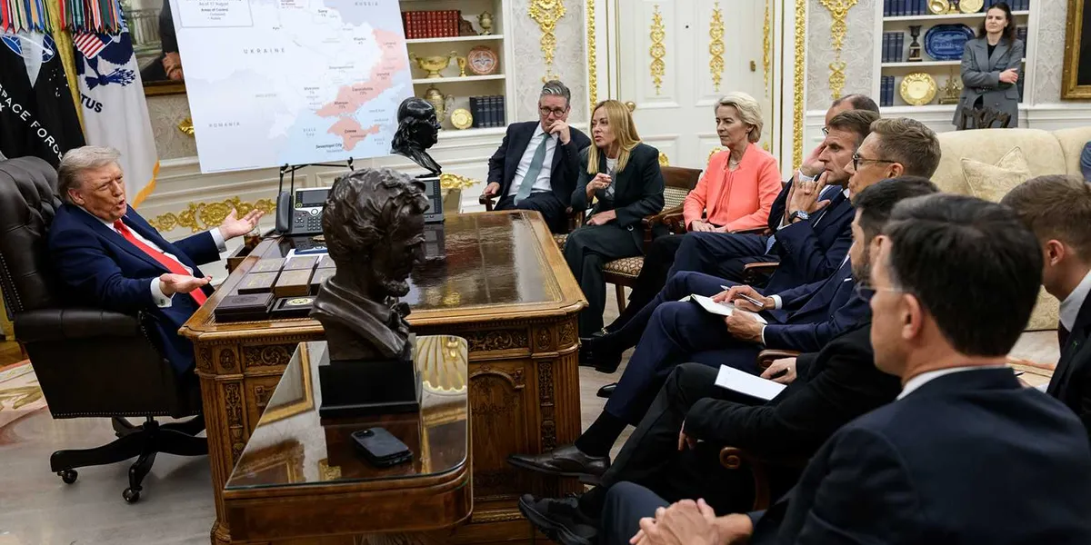
President Donald Trump posted an AI photo of himself in the Oval Office speaking to European leaders with a map of North and part of South America with the American flag covering not only the U.S. but Canada, Greenland and Venezuela.
Read more Trump’s idea to honor Lindsey Graham crashes and burns in Congress
The photo was likely taken during the leaders’ visit to the White House in Aug. 2025, but the map on the stand beside the desk wasn’t the one in the photo. According to an Instagram photo posted on the White House’s page on Aug. 19, 2025, the map primarily features Eastern Ukrainian provinces and Crimea. The White House uploaded the original photo to its Flickr page, which was then added to the Wikimedia Commons.
Trump replaced the map with one of his “manifest destiny” maps, featuring the American flag imposed over Canada, Greenland and Venezuela. Each country has been part of Trump’s ongoing efforts to have the U.S. take over countries.
Political experts and reporters noted that it appears Trump is growing bored with Iran again and seeking out Canada, Greenland and Venezuela to entertain him.
Former George W. Bush speechwriter David Frum noted, “On this map, Mark Carney would be the front-runner for the 2028 Democratic nomination and very likely next president of the United States.”
“Just in case Canada didn’t already loathe Trump enough,” said lawyer Scott Greenfield.
Researcher and psychologist Dr. Sam Youssef called the post “deranged” for covering Canada in American flags.
“There it is. Trump’s boredom with his Iran war had already led back to attacking NATO and proposals to annex Greenland. Now he’s remembered Canada, too,” wrote Kyle Orton, who writes about terrorism and national security.
Canadian news editor Trevor Robb joked about the boycotts in Canada of U.S. goods. Including the Trump takeover map, Robb implied that Americans appear clueless as to why the boycotts happen: “Why won’t Canada buy our booze??”
Read more Trump will try ‘self-pardon’ but he can still be held accountable: ex-federal prosecutor
MAGA fans and Trump loyalists were convinced it was 100 percent real and laughed at what they perceived to be an international version of “owning” world leaders.
“President Trump posted this absolute gem: Him in the Oval Office surrounded by European leaders with a map of GREENLAND, CANADA and VENEZUELA being claimed as USA territory. Cue the meltdowns,” said Eric Daugherty, the chief content officer at Right Line News, assuming the photo was real.
The account for Polymarket Intel that posts “breaking news & geopolitics,” also assumed the map was real.
The Daily Wire posted it with a laughing-crying emoji and a skeleton skull emoji.
Russia Today also posted it, though it made it clear that the photo was “his doctored Oval Office photo.”
“Wild post just now from Trump — appears to show August 18, 2025 WH meeting with Euro leaders The map shows Canada AND Venezuela colored in [with] American flag, more than 3 months before the Maduro raid,” wrote White House correspondent Christian Datoc with the conservative Washington Examiner. He later noted he thought the map may have shown Cuba in red and blue as well.
“Trump has once again posted a picture of a meeting of NATO leaders in the Oval Office where the map on the easel was changed from Ukraine to the US. Canada, and Greenland covered with the American flag. Why now? Maybe we’ll find out with Thursday’s speech,” said an anti-Trump protester, including the original photo.
Read more Trump just made a ‘stunning admission’ about his MAGA media manipulation plan
Another anti-Trump person noted, “I think that’s called the Moron Doctrine.”